The BEST Way-marked Route in the World!!!
The Lap
The route is predominantly on singletrack and un-manicured trails, with some sections of boardwalk, fire road, steeper fell paths and occasional unavoidable short sections of quiet country road.
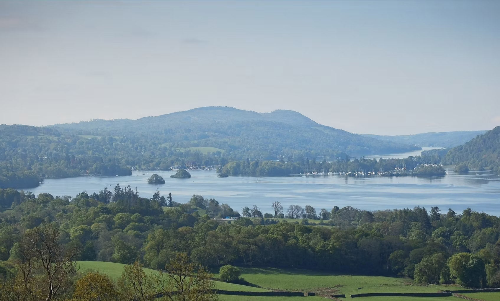
This is a low level Lake District route and so is an ideal introduction to off road distance running and will also mean we can and will go ahead, whatever the weather!
A GPX file of the route will only be sent to entrants before the event.
The route is 75K/47miles around and has 2,500m of ascent on completely ungroomed trails.
Route Map
A map will be provided on waterproof paper with the full route marked on it, plus all feed stations and halfway bag drop aid station and Emergency Phone Number.
This is by far the best way-marked route in Ultra and UK racing. No other event comes close.
You do not need to be proficient in navigation to take part in THE LAP, however it is the perfect event to practice. If you wish to progress in ultra running, navigation is an essential skill.
Additional maps at registration only £5.

Waymarking
The BEST way-marked route in The World!!!
The route will be heavily way-marked from the head of each trail, road crossing, and at all trail junctions.
There is no better way-marked ultra in the country!!!
Most people go wrong because of looking at their phone or chatting and missing an arrow. Our marshals see this all the time.

GPS - GPX
A GPX file of the route is attached to entry confirmation. The GPX is accurate route on the ground which is 47 miles, but no 2 devices will give you the same distance reading when uploaded.
You do not need a GPS device to take part in THE LAP. If you do not have one, then ignore everything related to the GPX. If you have a device and are having an issue uploading the GPX file, you need to read your instructions or ask Google.
THE LAP is by far the best way-marked route in Ultra in UK racing. No other event comes close.
You do not need to be proficient in navigation to take part in THE LAP, however, it is the perfect event to practice. If you wish to progress in ultra running, navigation is an essential skill.

Race Stats
Anticlockwise for most people takes a little longer because the hills around Ambleside are after the halfway point.
Distance - 75k / 47 miles
Elevation - 2,600m / 8,530ft of ascent/descent.
Surface
-95% trail/singletrack/path/forest road/northshore
- 5% country roads.
Approximate Distance Between Feed Stations
CLOCKWISE - MAY
Start - Far Sawrey:
3.15 miles/5km
Far Sawrey - Skelwith:
8 miles/12.9km
Skelwith Bridge - Troutbeck (Half Way in Elevation):
8.47miles/13.6km
Troutbeck - Matson Ground:
7.36miles/11.85km
Matson Ground - Ludderburn Moss (Water Only):
4.5miles/7.24km
Ludderburn Moss- Finsthwaite:
9.11miles/14.6km
Finsthwaite Hall - Finish:
5.35miles/8.6km
ANTICLOCKWISE - SEPT
Start - Finsthwaite Hall:
5.35miles/6.8km
Finsthwaite - Ludderburn Moss (Water Only):
9.11miles/14.6km
Ludderburn Moss (Water Only) - Matson Ground:
4.5miles/7.24km
Matson Ground - Troutbeck Hall (Half Way in Elevation):
7.36miles/11.85km
Troutbeck Hall - Skelwith Hall:
8.47miles/13.6km
Skelwith Hall - Far Sawrey Hall:
8miles/12.9km
Far Sawrey - Finish:
3.15miles/5km
The Lap Record
Beat the current KIRKBY LONSDALE BREWERY LAP RECORD and receive a prize of £250.
Increasing by £250 per year unbroken.

CLOCKWISE LAP RECORD
(F) Lucy Gossage - 2025
07:51:29
(M) Tom Smith - 2025
06:43:53

ANTICLOCKWISE LAP RECORD
(F) Catherine Spurden - 2022
08:35:17
(M) Barney Plummer - 2025
6:41:37